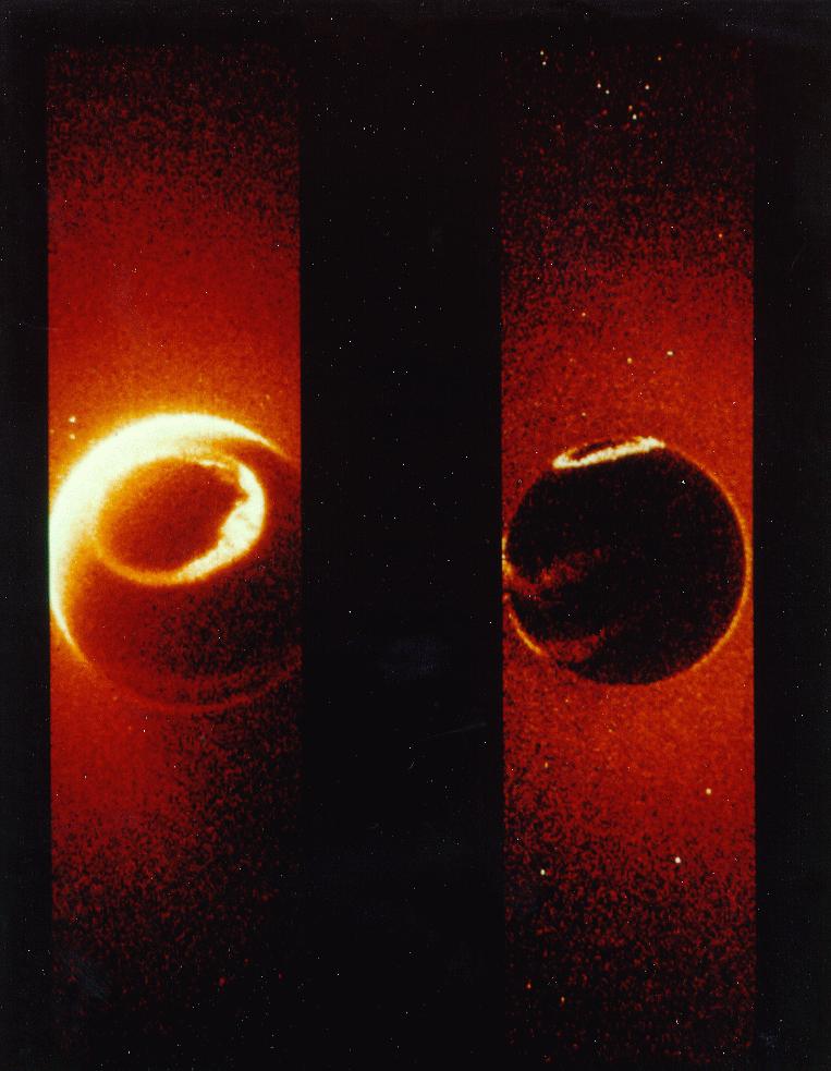
AMSR-E Weather Satellite Reveals the North Polar Entrance
In this video from the AMSR-E Japanese weather satellite you can clearly see a mysterious looking oval in the upper-right corner, just north of Greenland. On more than one occasion you can clearly see something streaming from this oval and in the process clearly demarcating or outlining the edge of the opening. Again on another occasion the ocean around the oval is blue and the weather patterns or clouds within the opening indicating the boundaries of the northern passage. Watch the video or click on the video stills below and discover the truth about our planet Earth.


posted by Shilo at 9:29 PM
![]()
![]()
14 Comments:
Your site is looking great "Shilo".
very interesting!
Hope someone finds some funds and explores that area...
Kindly give date and time of these Japanese satellite pics. Excellent job... bravo!!!
Rakesh,
this video,and stills are part of 7 minutes long NASA video composition which you could find on YOUTUBE under DAPACAP.
I placed there some more extraordinary evidence videos and remixes on poles holes
This hollow part is not a mystery, its the action of how imagery is collected and stored. Even though the earth is supposedly spherical, maps are generally projected on a piece of paper. Projections are never error free. And most map projections don't consider the poles with major significance. As there's not much inhabited there.
Put it this way, Google Maps is in a projection that is good to look at, and everyone is familiar with this projection. The problem with this projection is that the poles are stretched out. Now project those images onto a sphere, and now the poles' images are squished. The likelihood of any image captured at the poles is also non-existent because in this map projection, the length of the poles in relation to the projection approaches infinity. Therefore no data can be captured at the poles.
The way in which the globe is divided and data captured is Latitude Longitude, and any Longitude at +/- 90 Latitude is the same point as the Latitudes converge.
i didn't get what crazyenigma said, is he on crack or something?
Interesting article and video. It has sparked my interest in the hollow earth theory. I'm going to do an article on it, or would welcome any article you would like to post on my website, with any links to yours you want.
Take care Greg.
Can someone please share the name and web link of the video documentary of the hollow earth that was well received in Japan with awards. I have no information of the title or if it was in the Japanese language.
Thank everyone that are investigating anomalies and "outside the box" thinking and sharing information globally so that we may advance our collective consciousness.
LOVE & Peace
(GLOBALLY)
♥ 2012
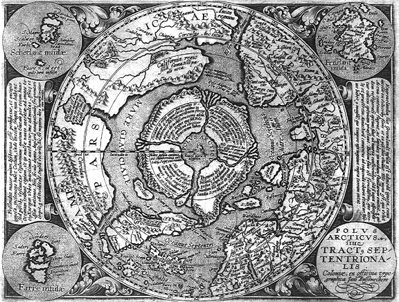
That 'hole' is the area south of Svalbard, west of Norway, and north of the UK/Shetland/Faroes. Hardly terra incognita!
Why doesn't the water pour in and fill up the hollow bit?
This hollow Earth stuff makes no real sense!
I would love to believe but the physics have to add up to be realistic.
@CrazyEnigma..here it is very clearly seen that its a 3D projection not a 2D,which means there is no question of stretching of poles..the video showed curvature of globe as well,dont try to make ur own story without any reasoning
For Anonymous at 4:45: The water does not pour into the North or South Pole entrances. A huge volume of fresh, tropical, river water is emitted at the South Pole. This accounts for the great fresh water icebergs created in those regions.
At the current North and South Poles, there are very large funnel openings. The small end of this squatted cone has a diameter of approximately 1400 miles. The rim of the cone is approximately 2200 miles. The holes at both poles are approximately the same size. These openings are so large that they are difficult to notice.
The molten and semi-molten Mantle is the source of gravity that holds mobile items to the surface in the interior as well as on the exterior of this thick crust. The mean thickness is approximately 800 miles. In the center of this shell is the Mantle. This is the center of Gravity. The Earth is approximately 8,000 miles in diameter. Approximately 90% of the Earth is hollow. The inside diameter of the Planet is approximately 6,000 miles. Since the mantle is 400 miles from any surface, even around the curve at the two openings, you could traverse from the surface, making the 1200 mile trip to the interior surface without realizing any difference whatsoever in the gravitational pull under your feet.
Since compasses refuse to work at such close proximity to their source of attraction, one could readily wander the circular slopes of the valley-cone and never suspect the true situation. The compass would point to the magnetic ring which is approximately 2200 miles in diameter and therefore is rendered useless.
We hope this explains the situation realistically.
Try this (with a smartphone)the next time you're on G.E. Go to Antarctica,then scroll to the center most point.
Take a photo of the area 'just above the center point'. Then, open edit & then select saturation. Click on this for several notches.
What you will see, is "blue water with a green coastline", within this area. It really starts to show with the 1st notch! (All under the "snow & ice" mask.)
Scroll back, until the entire land mass is within the frame of the monitor, then take a pic, then edit, add a couple of notches of blue on the RGB (if you have it), then turn up saturation.
West Antarctica will sink. While the rest turns green, with a detailed coastline. Turn the camera upside down, then process & "it does the same thing". And all this, under an 'ice' mask. Try it,it works!
This method also works for many 'official' photos as well.You can even tell if it's a painting, or a real photo with this method.
Post a Comment
<< Home