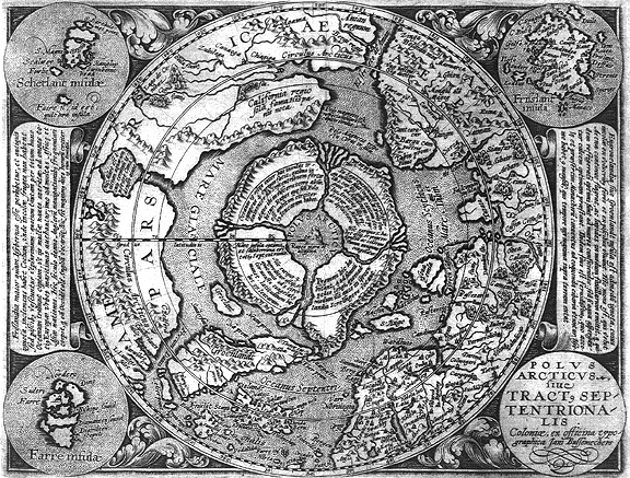
A Cartographic History of the Poles
Here you have a cartographer's dream. This is a 2 hour guided tour through the Lazeria private collection of historical maps reaching as far back as before the discovery of America. The historical walk-through of the maps of the polar regions shows that there was indeed a land at the poles (the Bargos Islands) that was well known to many of the explorers of the day. The Latin scripts of most of these maps are also divulged to give us an unusual dimension into the explorers' knowledge of this land.
Included in this narrative is not only Gerard Mercator's famous map of the Arctic but also the map of Schlarraffenland which is purported to be a map of a mysterious Utopia. The narrators of this guided tour (Harry Hubbard and Paul Schaffranke) believe it to be a possible map of the inner world.

posted by Shilo at 8:51 PM
![]()
![]()

2 Comments:
This was fascinating! Thanks for sharing.
Nice work! I have been looking 4 this and if you have more, even a inner globe :)Let me know. Please send anything you can and or just get a hold of me. Love to chat:) Thanks jaredmastej@yahoo.com
Post a Comment
<< Home